Tag: Shows
Satellite Data Shows US East Coast is Sinking
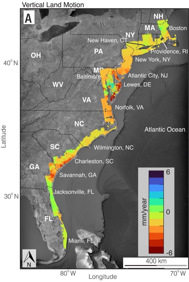
Based on satellite imagery, geologist have determined major cities on the U.S. Atlantic coast are sinking, some areas as much as 2 to 5 millimeters (.08-0.2 inches) per year. Called subsidence, this sinking of land is happening at a faster rate than was estimated just a year ago. In a new paper published in the…